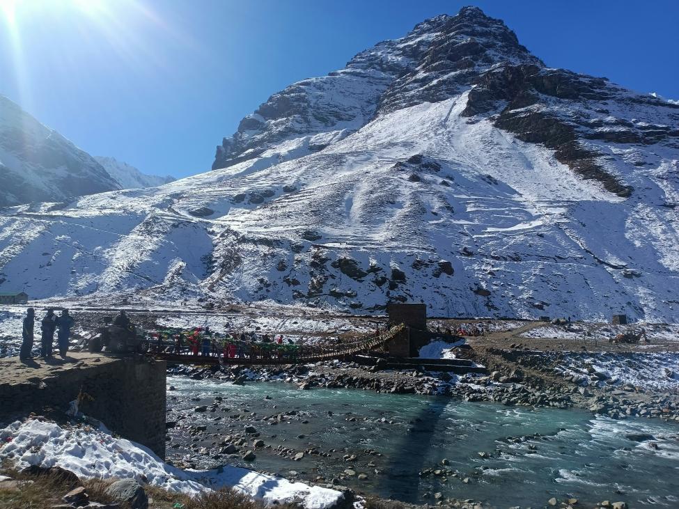
 Khardung La Pass - Ladakh,
Top High-Altitude Passes in India, Ladakh, Rohtang & More
From Khardung La to Rohtang Pass, Nathu La to Mana Pass, India has some of the world’s most stunning high-altitude roads and passes. This guide covers altitudes, routes, travel tips, adventure activities, and local insights for each pass, making it the ultimate resource for bikers, road-trippers, and Himalayan explorers
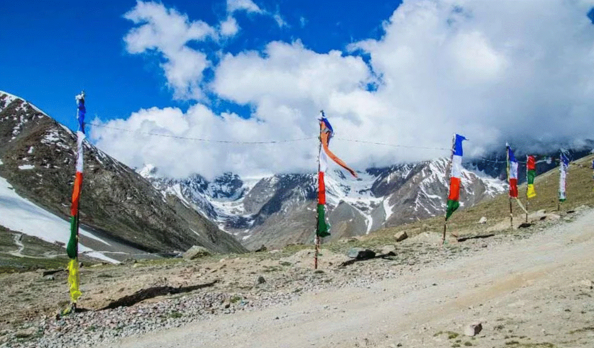
1. Chang La (Ladakh),
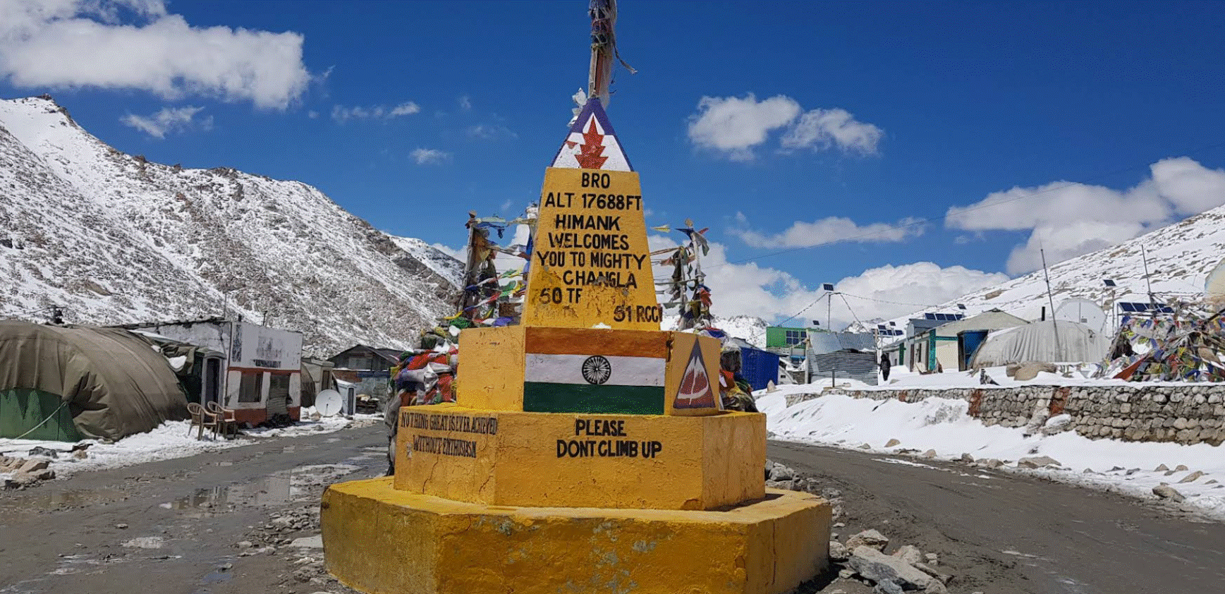
Chang La is one of the highest motorable passes in the world, standing at an impressive 5,360 meters (17,590 feet) above sea level. Located in Ladakh, it connects Leh town to the stunning Pangong Tso Lake, making it a crucial route for travelers heading east from Leh. Chang La is also part of the Leh - Darbuk - Pangong highway, which is often included in adventure motorcycle trips and road trips in Ladakh.
- Altitude: 5,360 m (17,590 ft)
- Connects Leh to Pangong Tso
- Road condition, best time, permits, and nearby attractions
- Adventure tips: photography, short treks, acclimatization
The pass gets its name from “Chang,” meaning north, and “La,” meaning pass. It’s a gateway to remote landscapes, glacial valleys, and high -altitude meadows. Unlike the crowded tourist spots like Pangong, Chang La offers serenity and breathtaking panoramic views.
How to Reach Chang La:
- From Leh: About 40 km from Leh, the drive to Chang La usually takes 1.5 - 2 hours. The road is partially paved but can be rough, especially near the summit due to snow and rocks.
- By Motorcycle: Many bikers love to tackle Chang La as part of Leh-Ladakh road trips, experiencing challenging curves and high - altitude thrills.
- Nearest Towns: Leh (40 km), Darbuk (25 km beyond the pass toward Pangong).
- Tip: Start early in the day to avoid congestion and snow - related delays.
Weather and Best Time to Visit
- May to September: Ideal for visiting, as the road is open and snow is manageable.
- October to April: Roads often close due to heavy snowfall. Temperatures can drop below -10°C.
- Dress in layers, carry windproof jackets, gloves, and sunglasses for sun reflection on snow.
Attractions & Activities
- Panoramic Views: The pass offers spectacular 360° views of snow peaks and glacial valleys.
- Photography: Sunrise and sunset over Chang La are stunning for photography enthusiasts.
- Adventure: High-altitude driving, motorbike trips, and trekking opportunities in nearby valleys.
- Pangong Lake Detour: From Chang La, travelers continue to Pangong Tso, one of the most photographed lakes in India.
Travel Tips
- Acclimatization: Spend 1 - 2 days in Leh before attempting Chang La to avoid altitude sickness.
- Snacks & Water: Few shops exist at the summit; carry water and light snacks.
- Oxygen Support: Some travelers carry portable oxygen for quick relief.
- Photography: The pass is open year-round (summer months), perfect for wide-angle and landscape photography.
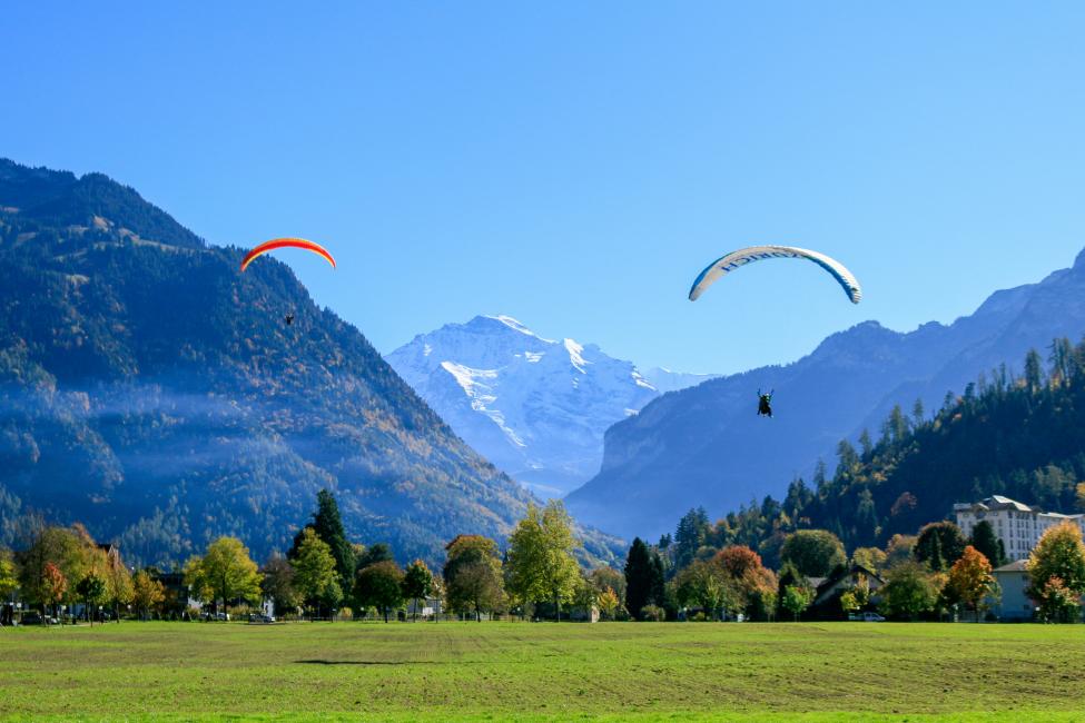
2. Rohtang Pass (Himachal Pradesh),
Rohtang Pass is a high - altitude mountain pass located at 3,978 meters (13,051 feet) in Himachal Pradesh, connecting Manali to the Lahaul and Spiti valleys. It’s famous for snow - capped peaks, glaciers, and adventure sports. Rohtang is considered one of the most accessible high Himalayan passes in India, making it popular among tourists, bikers, and road-trippers.
- Altitude: 3,978 m (13,051 ft)
- Manali - Lahaul Valley gateway
- Snow activities, Solang Valley connection, permits, road tips
- Best time to visit and travel recommendations
The pass is surrounded by lush green slopes in summer, and winter transforms it into a snow paradise, offering a playground for skiing, snowboarding, and sledging. Rohtang also serves as a strategic route for locals traveling to Lahaul.
How to Reach Rohtang Pass
- From Manali: 51 km via Gulaba and Rahala; the drive takes 2–3 hours.
- By Car or Bike: Private taxis, rented cars, or motorcycles are popular.
- Nearest Towns: Manali (51 km), Solang Valley (30 km), Gulaba (20 km before pass).
- Tip: Travel early morning to avoid traffic and afternoon snowfall.
Weather and Best Time to Visit
- May to October: Roads are open and snow is partially visible at higher altitudes.
- December to February: Heavy snow makes the pass challenging; winter sports enthusiasts can still visit but with local guidance.
- Temperatures range from -5°C in summer to -20°C in winter.
Attractions & Activities
- Snow Activities: Skiing, snowboarding, sledging, and snowball fights.
- Solang Valley Proximity: Paragliding, ATV rides, zip-lining.
- Photography: Snow-capped mountains, meadows, and icy rivers create incredible landscapes.
- Road Trips: Manali–Rohtang is a favorite motorcycle expedition route.
Travel Tips
- Permit Required: Only a limited number of vehicles are allowed daily; book online via the Himachal government portal.
- Clothing: Layered clothing, gloves, and windproof jackets are essential.
- Altitude Awareness: Though lower than Ladakh passes, sudden headaches or nausea may occur.
- Stay Options: No accommodations at the pass; Manali or Solang Valley are nearby.
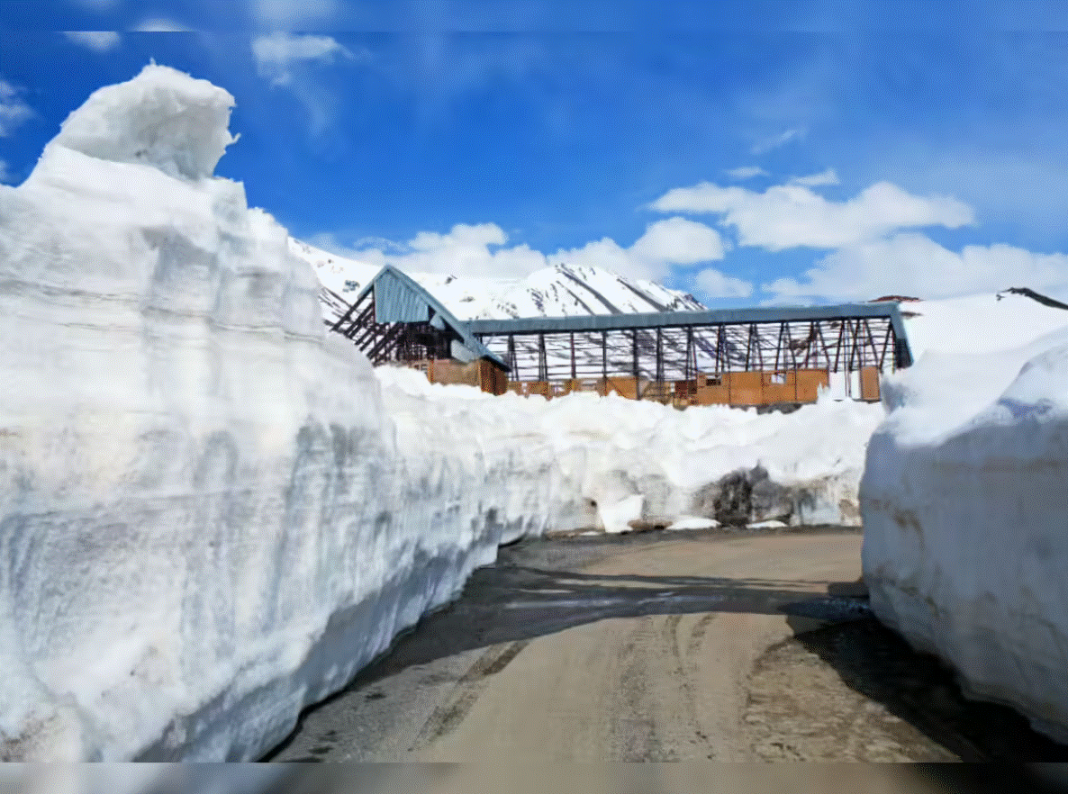
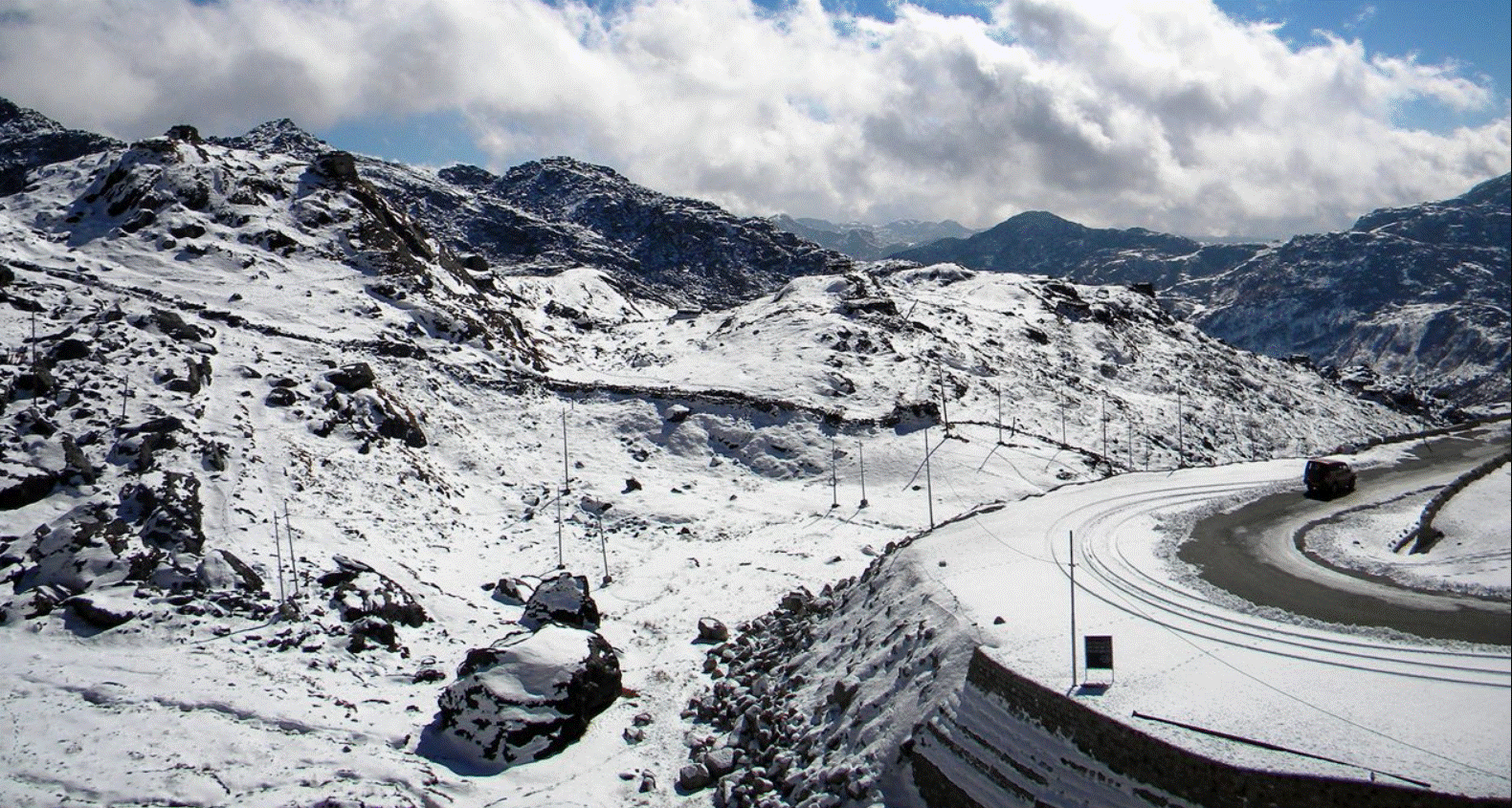
3. Khardung La (Ladakh)
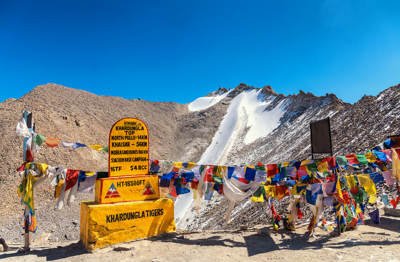
Khardung La, at 5,359 meters (17,582 feet), is one of the highest motorable passes in the world and a must-visit destination for travelers in Ladakh. Located 40 km north of Leh, it serves as the gateway to Nubra Valley and historically, the Siachen Glacier.
- Altitude: 5,359 m (17,582 ft)
- Gateway to Nubra Valley and Siachen Glacier
- Motorcycle and jeep road trips
- Acclimatization tips, viewpoints, BRO cafe
Khardung La is iconic for its motorcycle expeditions, 4x4 drives, and panoramic Himalayan views. The pass is often visited as part of Leh - Nubra road trips and adventure biking tours. Its snowy slopes and rocky terrain make it a high-altitude adventure hotspot.
How to Reach Khardung La
- From Leh: 39 - 40 km via South Pullu check post. Takes about 1.5 - 2 hours by car or bike.
- By Motorcycle: Extremely popular for bikers attempting the highest motorable roads in India.
- Nearest Towns: Leh (40 km), North Pullu, Nubra Valley (70 km beyond the pass).
- Tip: Acclimatize in Leh before attempting Khardung La; high altitude requires caution.
Weather and Best Time to Visit
- May to September: Roads open, less snow accumulation, safer for travel.
- Winter (Oct - Apr): Heavy snow, pass often closed, extreme cold.
- Temperatures: Summer: 5°C–15°C, Winter: -20°C to -35°C.
Attractions & Activities
- Panoramic Views: Snow-capped peaks and rugged landscapes make Khardung La a photographer’s paradise.
- Adventure: Motorcycling, jeep safaris, and high-altitude trekking near Nubra Valley.
- Cultural Stops: North Pullu monastery and Nubra villages offer local Ladakhi culture.
- Highest Motorable Road: Attracts bikers worldwide to challenge the altitude and terrain.
Travel Tips
- Acclimatization is key: Spend 1–2 days in Leh before heading to Khardung La.
- Oxygen cylinders: Recommended for travelers prone to altitude sickness.
- Road condition: Mostly paved but narrow and winding; drive carefully.
- Facilities: Small tea stalls at North Pullu, limited at the summit.
Banihal Pass (Jammu & Kashmir)
Banihal Pass, at 2,832 meters (9,288 feet), is a historically significant pass in Jammu & Kashmir. It connects Jammu to the Kashmir Valley via the Jammu–Srinagar highway. Unlike the extreme Himalayan passes of Ladakh, Banihal Pass is more accessible, lower in altitude, and plays a vital role in trade and transportation.
- Altitude: 2,832 m (9,288 ft)
- Jammu - Kashmir road connectivity (Jammu - Srinagar Highway)
- Historical importance, snow season, road condition, and nearby villages
The pass is surrounded by lush forests and steep hills, creating a mesmerizing scenic experience during the summer months. In winter, the pass sees heavy snowfall, often blocking the Srinagar - Jammu highway.
How to Reach Banihal Pass
- From Jammu: 135 km via NH44; takes 4 - 5 hours by car.
- From Srinagar: 110 km, about 3 - 4 hours.
- By Train: Banihal railway station connects with the Jammu - Baramulla line.
Weather and Best Time to Visit
- April to October: Roads are open, greenery in full bloom.
- November to March: Heavy snowfall can block access; winter driving is challenging.
- Temperatures: Summer: 15 - 25°C, Winter: -5°C to -10°C.
Attractions & Activities
- Jawahar Tunnel: Iconic tunnel near the pass connecting Jammu with Kashmir Valley.
- Snow Activities: Light snow fun during winter; skiing is rare due to accessibility.
- Scenic Drives: The pass offers lush forests, rivers, and mountains, perfect for photography.
- Cultural Interaction: Local villages and markets provide insight into Kashmiri lifestyle.
Travel Tips
- Road conditions: Well-paved but may be slippery during snow.
- Timing: Travel early in the day to avoid congestion.
- Stay: Hotels in Banihal or Qazigund; Srinagar or Jammu for longer stays.
- Local Cuisine: Try traditional Kashmiri snacks at roadside dhabas.
5. Mana Pass (Uttarakhand)
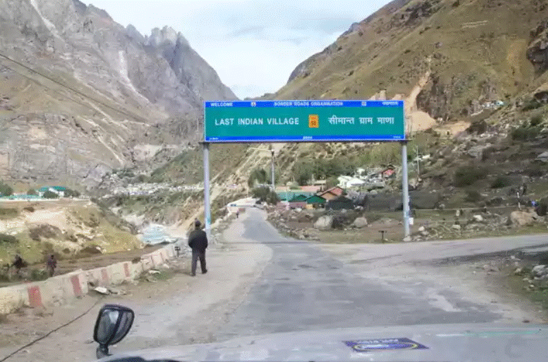
Mana Pass is one of the highest vehicle-accessible passes in India, situated at an altitude of 5,610 meters (18,406 feet) in Uttarakhand, near the India-Tibet border. It lies just beyond the village of Mana, which is the last inhabited village on the Indian side of the border. This pass is strategically important and has historically been used for trade routes into Tibet.
- Altitude: 5,610 m (18,406 ft)
- Near Mana village, gateway to Tibet
- Trekking focus, restricted areas, adventure preparation
- Spectacular views of Himalayas
The pass offers a dramatic Himalayan landscape with snow - capped peaks, glaciers, and high-altitude desert terrain. It is not heavily trafficked, making it a serene yet challenging destination for adventure trekkers and high-altitude explorers.
How to Reach Mana Pass
- From Joshimath: 80 km by road to Mana village, then a rough track continues to the pass.
- From Rishikesh/Haridwar: Approximately 530 km; the journey takes 14–16 hours by road.
- Nearest Towns: Mana village (last settlement), Badrinath (~3 km from Mana).
- Tip: Only experienced travelers with high-altitude acclimatization should attempt the trek beyond Mana village.
Weather and Best Time to Visit
- July to September: The safest months with snow-free conditions on the approach track.
- October to June: Heavy snow blocks access; extreme cold makes the pass dangerous.
- Temperatures: Summer 0 - 10°C; Winter -20°C to -30°C.
Attractions & Activities
- High-Altitude Trekking: Mana Pass is primarily visited by mountaineers and trekkers; it’s not suited for casual tourists.
- Glacial Views: Explore nearby glaciers and streams for photography and adventure.
- Cultural Experience: Visit Mana village, see traditional Tibetan-influenced homes, and Badrinath temple nearby.
- Adventure Photography: The pass offers epic landscapes, snowfields, and Himalayan vistas.
Travel Tips
- Acclimatization: Spend at least 2 - 3 days at Badrinath or Joshimath before ascending.
- Permit Required: Check with local authorities; foreign nationals often require restricted area permits.
- Travel Gear: Warm clothing, trekking boots, sunglasses, and gloves are essential.
- Safety: Avoid visiting alone; hire a guide if attempting the trek to the pass.
Marsimik La (Ladakh)
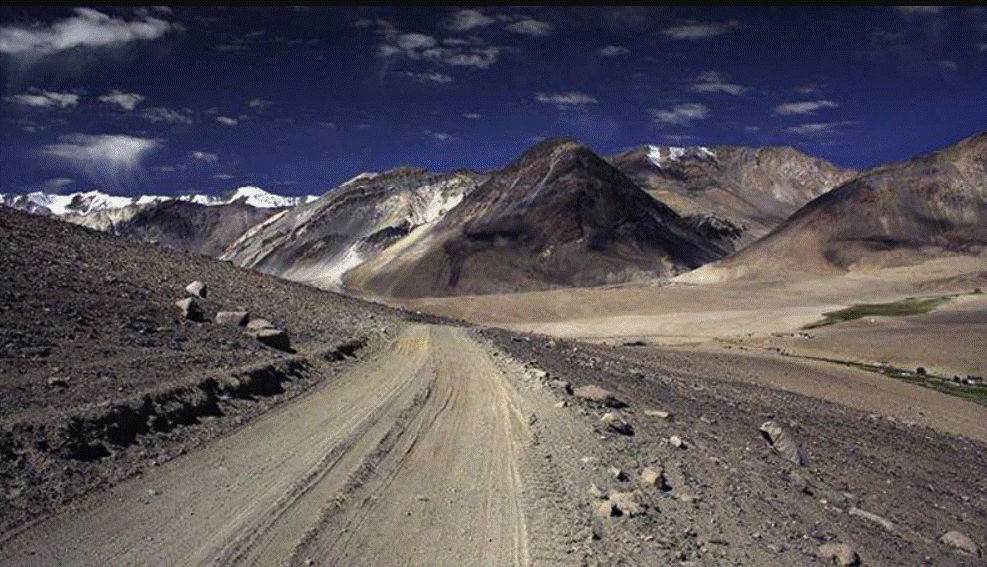
Marsimik La, located in Ladakh, is one of the world’s highest motorable passes, with an altitude of 5,582 meters (18,314 feet). It serves as an extension of the Leh - Pangong Tso route and is situated near the north-eastern side of Pangong Lake. While not as widely visited as Chang La or Khardung La, it is a bucket-list destination for bikers and off - road adventurers.
- Altitude: 5,582 m (18,314 ft)
- One of the highest motorable passes in the world
- Road conditions, accessibility, adventure tips
- Connection to Pangong Tso and Chang La route
Marsimik La is surrounded by desolate mountains, high-altitude plains, and occasional frozen streams, offering an untouched and dramatic landscape.
How to Reach Marsimik La
- From Leh: 200+ km via Chang La and Tangtse; the route is rough and requires 4x4 vehicles or adventure motorcycles.
- Nearest Towns: Tangtse (base for exploration), Pangong Tso (south-western approach).
- Travel Requirement: Highly recommended for experienced off-road travelers only.
Weather and Best Time to Visit
- May to September: The pass is accessible; roads are difficult but manageable with off-road vehicles.
- Winter: Completely snowbound; extreme cold makes it impossible for casual travelers.
- Temperatures: Summer 0 - 10°C; Winter -20°C to -35°C.
Attractions & Activities
- High - Altitude Photography: Stunning vistas of frozen streams, snow-covered peaks, and barren mountain landscapes.
- Motorbike Expeditions: Marsimik La is considered an extreme adventure challenge for bikers attempting Leh-Pangong off-road circuits.
- Pangong Lake Access: Offers dramatic backdrops for photography and camping.
- Remote Exploration: The pass is less crowded, offering a sense of solitude in the Himalayas.
Travel Tips
- Acclimatization is Crucial: Spend time in Leh and along Chang La before attempting Marsimik La.
- Vehicle Requirements: High-clearance 4x4 vehicles or strong motorcycles recommended.
- Carry Essentials: Water, food, and warm clothing; no shops are available en route.
- Guides Recommended: Hire a local guide if unfamiliar with terrain.
Nathu La (Sikkim)
Nathu La Pass is a famous mountain pass on the India–China border, located at 4,310 meters (14,140 feet) in Sikkim. It is part of the historic Silk Route and serves as a trade route connecting Sikkim to the Chumbi Valley in Tibet. Nathu La is one of the most visited border passes in India, known for its strategic importance and scenic beauty.
- Altitude: 4,310 m (14,140 ft)
- Trade route and tourist permit requirements
- Scenic beauty, views of Chumbi Valley
- Travel tips: restricted entry, photography rules
The pass is surrounded by green slopes, snow-capped mountains, and high-altitude streams, offering an accessible Himalayan experience for tourists.
How to Reach Nathu La
- From Gangtok: 54 km, about 3 hours by car via Ranka, Mangan, and Tsokha.
- Nearest Towns: Gangtok (state capital), Mangan (base for sightseeing).
- Permit Requirement: Tourists require a restricted area permit (RAP) to visit Nathu La; foreigners require additional clearance.
Weather and Best Time to Visit
- May to October: Ideal for visiting; roads are open, landscapes are lush, snow peaks visible.
- November to April: Cold and occasional snowfall; restricted access may apply.
- Temperatures: Summer 10–20°C; Winter -5°C to 5°C.
Attractions & Activities
- Border Viewing: Indian and Chinese army posts visible; military history enthusiasts enjoy guided tours.
- Photography: Stunning snow-capped peaks, mountain valleys, and streams.
- Local Markets: Handicrafts, Sikkimese souvenirs, and Tibetan artifacts.
- Silk Route History: Learn about historic trade between India and Tibet.
Travel Tips
- Permit Required: Obtain RAP in advance through Sikkim tourism offices.
- Travel Early: Roads can be narrow; start early to avoid rush and afternoon weather changes.
- Clothing: Carry warm clothing even in summer; weather changes quickly.
- Altitude Awareness: Mild altitude sickness is possible; hydrate well.
8. Debsa Pass (Himachal Pradesh)
Debsa Pass, at an altitude of 5,400 meters (17,716 feet), is a remote trekking pass connecting Spiti and Lahaul Valleys in Himachal Pradesh. Unlike motorable passes, Debsa is primarily for trekkers and high - altitude explorers, offering a raw Himalayan adventure.
- Altitude: 5,400 m (17,716 ft)
- Trekking route between Spiti and Lahaul
- Remote and adventurous, requires experience
- Best months and trekking tips
The pass is surrounded by rocky slopes, glaciers, and barren Himalayan landscapes, making it a challenging but rewarding trek for experienced adventurers.
How to Reach Debsa Pass
- Starting Point: Keylong in Lahaul or Kaza in Spiti Valley.
- Trekking Route: Requires 4 - 6 days depending on acclimatization and weather.
- Nearest Villages: Kibber, Dhankar, and Losar in Spiti.
Weather and Best Time to Visit
- July to September: Best time for trekking; snow is manageable, weather stable.
- October to June: Extreme cold and snow make trekking impossible.
- Temperatures: Summer 0–10°C; Winter -20°C to -30°C.
Attractions & Activities
- High - Altitude Trekking: Debsa Pass is a challenging route for trekkers seeking adventure.
- Glaciers & Valleys: Stunning views of Spiti glaciers, rivers, and barren mountain terrain.
- Cultural Stops: Explore remote Spitian villages and monasteries along the trekking route.
- Photography & Adventure: Unique landscapes for photography; solitude and wilderness experience.
Travel Tips
- Experienced Trekking Only: Suitable for trained trekkers with proper gear.
- Acclimatization: Essential due to extreme altitude; spend 2 - 3 days in Keylong or Kaza.
- Carry Essentials: Water, food, medical kit, and warm clothing.
- Guides Recommended: Hire local guides for safety and route navigation.
 Dwarkadhish Temple - Mathura Tra..
 Mathura Museum (Government Museu..
 Prem Mandir, Rajkot - A Spiritua..
 Huzoor Palace Porbandar - Royal ..
 Ram Tirth Amritsar, Punjab..
 Chandni Chowk Market Delhi - Sho..
 National Museum Delhi - Journey ..
 Hazratbal Shrine Srinagar: Histo..
 Coronation Park Delhi - A Monume..
 Top 5 Places to Visit in Haridwa..
 Agam Kuan, Patna - The Mysteriou..
 Madan Mohan Temple Vrindavan –..
 Indroda Nature Park Gandhinagar ..
 Fatehpur Sikri - The Lost Mughal..
 Bhagsu & Dharamkot Travel Guide ..